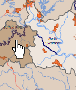
The Clean Water Act requires states to develop and maintain water quality standards, where pollutants in a river, lake or stream cannot exceed certain concentrations. The Water Division of the Arkansas Department of Environmental Quality determines these concentrations and publishes inventories documenting the state's impaired waterbodies.
2008 - Draft Inventory of 303(d) Impaired Waters (ADEQ, PDF)
2006 - Draft Inventory of 303(d) Impaired Waters (ADEQ, PDF)
2004 - Inventory of 303(d) Impaired Waters (ADEQ, PDF)
2002 - Inventory of 303(d) Impaired Waters (ADEQ, PDF)
1999 - Inventory of 303(d) of Impaired Waters (ADEQ, PDF)
EPA Section 303(d) List Fact Sheet for Arkansas
Reformatted 2004-2008 Inventory of Impaired Waters (ArkansasWater, Excel)
Each inventory contains the "reach" or stream segment that is impaired, the 8-digit watershed that contains the impaired reach, the length of the reach, the designated uses of the reach and their status, and the sources and causes of pollution.
Designated Uses
The designated uses are designated by federal and state organizations. Federally, all streams are required to be suitable for the following uses:
Primary Contact (Swimming)
Secondary Contact (Wading)
Fisheries and Fishing
Domestic Water Supply
Agricultural Water Supply
Industrial Water SupplyIn addition, Arkansas has designated certain streams and reaches to have more sensitive uses than the rest, and thus higher standards.
Extraordinary Resource Waters
Some 16% of Arkansas' total stream miles have been designated as Extraordinary Resource Waters (ERW). ERWs are characterized by scenic beauty, aesthetics, scientific values, broad scope recreational potential and intangible social values.
Ecologically Sensitive Waters
Ecologically Sensitive Waters (ESW) include segments known to provide habitat within the existing range of threatened, endangered or endemic species of aquatic or semi-aquatic life forms.
Natural and Scenic Waterways
Arkansas has designated parts of five rivers as Natural and Scenic rivers: Cossatot River, Little Missouri River, Saline River, Strawberry River, and Kings River. The United States has also designated parts of rivers as Natural and Scenic: Big Piney Creek, Buffalo River, Cossatot River, Hurricane Creek, Little Missouri River, Mulberry River, North Sycamore Creek, and Richland Creek.
When one or more designated uses are not supported, a type or types of pollution, called "cause(s)" must be identified. These causes are organized into the following categories:
SI = Siltation or Turbidity
AM = Ammonia
NO3 = Nitrogen
TP = Total Phosphorus
NU* = Nutrients (No3, TP)
DO = Dissolved Oxygen
PA = Pathogen Indicators (Bacteria)
CL = Chlorides
SO4 = Sulfates
TDS = Total Dissolved Solids
OE = Organic Enrichment
PO = Priority Organics
Al = Aluminum
Cu = Copper
Pb = Lead
Zn = Zinc
Hg = MercuryEvery pollutant has a corresponding "source" or likely origin.
AG = Agrilculture
SE = Surface Erosion
RE = Resource Extraction
SV = Silviculture
UR = Urban Runoff
RC = Road Construction/Maintenance
IP = Industrial Point Source
MP = Municipal Point Source
HP = Hydropower
UN = Unknown
For more information about the impairment assessments and Total Maximum Daily Loads, visit the following page.
For a more thorough discussion of impaired waters, visit the Arkansas Department of Environmental Quality and examine Regulation 2.
