Land Use Data

Land use data provided by:

Center for Advanced Spatial Technologies
304 JBHT, University of Arkansas, Fayetteville AR 72701
Phone: (479)575-6159 | Fax: (479)575-5218 | Email: This email address is being protected from spambots. You need JavaScript enabled to view it.

http://www.cast.uark.edu/ 


Announcements

  • Clean Water Act Section 303(d) Impaired Waters Data Update here
  • Arkansas’s Final/ Draft Impaired Waterbodies – 303(d) List by Year here
  • AR Water Newsletter, Summer, 2015 here
  • NPS Management Plan (PDF) here
  • The projects presented at the 2015 annual NPS conference are located here

Interactive Map

Interactive Watershed Viewer
 
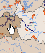
Explore your county or watershed with this flash-based interactive map.  View over 25 geographic and water-related layers. Open Interactive Watershed Viewer.