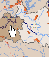
A watershed is the area of land where water drains downhill into a single body of water.
The Watershed Concept - A Flash Animation (Michigan Tech University)
The U.S. Geological Survey has defined roughly equal-sized watersheds for the United States at various scales, and a Hydrologic Unit Code (HUC) has been assigned to each watershed.
Just as a house is assigned a numeric zip code, watersheds are assigned a numeric locator, called a Hydrologic Unit Code (HUC). A HUC can have anywhere from 2 to 12 digits. The more digits, the smaller the land area of the watershed. In this website, you will find information for 8-digit Hydrologic Unit Codes. There are 57 of these 8-digit watersheds in Arkansas.
Arkansas Watersheds - An Overview (University of Arkansas Cooperative Extension)
Major basins, like the Mississippi River Basin, are sub-divided into smaller basins, like the Arkansas River Basin and the Red River Basin, which are further sub-divided into smaller and smaller watersheds. The smaller, more local the watershed my neighbors and I decide to focus our efforts on -- the more likely we can generate measurable results. And results get people excited!
Find Your Watershed (Arkansas Watershed Information System)
