Each category contains advice on how to minimize damage to aquatic ecosystems.
- Household & Small Business Practices
- Agricultural Practices
- Forestry/Silviculture Practices
- Highway Construction and Maintenance
- Urban Stormwater Management
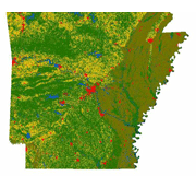
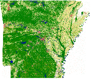
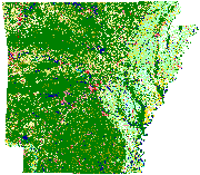
How is the land being used in your area?* Examine the maps below, or use the interactive map to see 2006 land use with other selectable features. *Note: The maps below were compiled and created using different methodologies as resources and technologies evolved. Direct comparison between maps is difficult at best. The maps below were created by the Center for Advanced Spatial Technologies (cast.uark.edu)
| 1999 Land Use (CAST) | 2004 Land Use (CAST) | 2006 Land Use (CAST) |
 |
 |
 |
| (enlarge map) | (enlarge map) | (enlarge map) |
| Download Fullsize TIFF (211 MB) |
