|
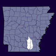
Home to approximately 40,000 Arkansans (2000 Census), the Lower Saline watershed lies within the Ouachita River Basin in Southern Arkansas. The hydrologic unit code for this watershed is 08040204. Upstream is the Upper Saline (08040203). The Lower Ouachita- Bayou De Loutre (08040202) is downstream. |
||
 |
 |
 |
|
|
|
|
| County Pages (Contact Information) |
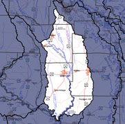
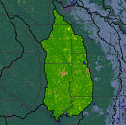
Major Streams | 2006 Land Use (1,503 Square Miles) |
|
|
|
Lower Saline 303d Impaired Streams (what is an impaired stream?)
Total Maximum Daily Load (TMDL) Documents (what is a TMDL?)
More Watershed-Related Information
- CAST Arkansas Watershed Information System: Lower Saline
-
EPA Surf Your Watershed: Lower Saline
-
USGS Real Time Stream Flow: Lower Saline
-
USGS Links to Water Quality & Groundwater Monitoring Sites: Lower Saline
-
Environmental Statistics Group (Montana State University): Lower Saline